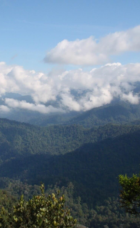
Pine Tree Hill is the longest and most challenging hill to hike in Fraser's Hill. After hours of trekking, there's a beautiful panoramic view on the peak of the hill - of a forest of landscape and mountains on clear days.
Opening hours
Always open
What to expect?
What to expect?
Pine Tree Hill Trail is the longest trail in Fraser’s Hill and also the most challenging. The trail started during the British era to gain access to a mountain peak that commanded a majestic a view of Fraser’s Hill and the surrounding summits. The trail derived its name from 5 old stag-headed endemic conifers of the dacrydium comosum species. Only one of these trees (which are only found in Malaysia) still remains at the summit of Pine Tree Hill.
Pine Tree Hill Trail is the most challenging trail in Fraser’s Hill. The trail will really help to work your cardio like no other treadmill would. A 4 hour hike of undulating, calf straining high mountain forest trail but wait… and a killer view of the Titiwangsa range from 4000 ft high. There’s a bonus view if hikers come around dawn when the mists starts to rise up among the plush lower tropical forests and building up to a thick foggy crescendo.
Pine Tree Hill Trail is the most challenging trail in Fraser’s Hill. The trail will really help to work your cardio like no other treadmill would. A 4 hour hike of undulating, calf straining high mountain forest trail but wait… and a killer view of the Titiwangsa range from 4000 ft high. There’s a bonus view if hikers come around dawn when the mists starts to rise up among the plush lower tropical forests and building up to a thick foggy crescendo.
What to see there?
What to see there?
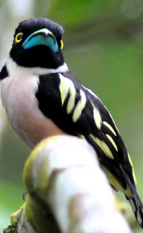
The trail’s highest point is 1505 meters above sea level. Although this is only 300 meters higher than the starting altitude of around 1200 meters. The trail is 5.5km long and most people take 7 to 8 hours to trek the summit and back again. The trail offers seasoned hikers a healthy challenge to test their endurance and also rewards them in terms of the variety of flora and fauna of the lower montane forest.
Safety tips
Safety tips
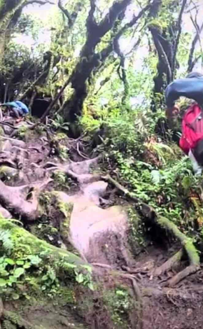
There are quite a number of uphill climbs, followed by steep, slick downhill terrain to overcome. Coupled with the challenge of navigating one’s body over branches that have been uprooted, foot placement would become extremely important.
Who should I travel with?
Who should I travel with?
Solo , Couple , Friends
What to bring?
What to bring?
We advise you to bring at least 2-3 litres of water, energy food, and wear good footwear (Don’t even think that you can wear those open trek sandals as the chances are that you will whack your toes against hidden jagged branches). Also bring trekking poles to ease the strain on your knees when going downhill.
Insiders’ tips
Insiders’ tips
Plan your hiking because it gets dark in there faster than you think. The gate at the top opens to downhill traffic at 4pm, 6pm and 8pm for 40 minutes at a time.
What to expect?
What to expect?
Pine Tree Hill Trail is the longest trail in Fraser’s Hill and also the most challenging. The trail started during the British era to gain access to a mountain peak that commanded a majestic a view of Fraser’s Hill and the surrounding summits. The trail derived its name from 5 old stag-headed endemic conifers of the dacrydium comosum species. Only one of these trees (which are only found in Malaysia) still remains at the summit of Pine Tree Hill.
Pine Tree Hill Trail is the most challenging trail in Fraser’s Hill. The trail will really help to work your cardio like no other treadmill would. A 4 hour hike of undulating, calf straining high mountain forest trail but wait… and a killer view of the Titiwangsa range from 4000 ft high. There’s a bonus view if hikers come around dawn when the mists starts to rise up among the plush lower tropical forests and building up to a thick foggy crescendo.
Pine Tree Hill Trail is the most challenging trail in Fraser’s Hill. The trail will really help to work your cardio like no other treadmill would. A 4 hour hike of undulating, calf straining high mountain forest trail but wait… and a killer view of the Titiwangsa range from 4000 ft high. There’s a bonus view if hikers come around dawn when the mists starts to rise up among the plush lower tropical forests and building up to a thick foggy crescendo.
What to see there?
What to see there?
The trail’s highest point is 1505 meters above sea level. Although this is only 300 meters higher than the starting altitude of around 1200 meters. The trail is 5.5km long and most people take 7 to 8 hours to trek the summit and back again. The trail offers seasoned hikers a healthy challenge to test their endurance and also rewards them in terms of the variety of flora and fauna of the lower montane forest.
Safety tips
Safety tips
There are quite a number of uphill climbs, followed by steep, slick downhill terrain to overcome. Coupled with the challenge of navigating one’s body over branches that have been uprooted, foot placement would become extremely important.
Who should I travel with?
Who should I travel with?
Solo , Couple , Friends
What to bring?
What to bring?
We advise you to bring at least 2-3 litres of water, energy food, and wear good footwear (Don’t even think that you can wear those open trek sandals as the chances are that you will whack your toes against hidden jagged branches). Also bring trekking poles to ease the strain on your knees when going downhill.
Insiders’ tips
Insiders’ tips
Plan your hiking because it gets dark in there faster than you think. The gate at the top opens to downhill traffic at 4pm, 6pm and 8pm for 40 minutes at a time.
