If you are interested on history of the WW2 and looking for a great way to get some exercise , then Gunung Telapak Buruk would be the perfect hike for you!
Opening hours
Always open
What to expect?
What to expect?
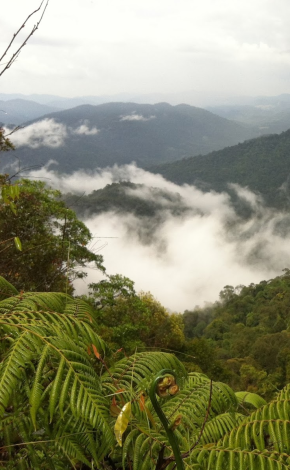
Gunung Telapak Buruk is a mountain located near Seremban town, Negeri Sembilan - and stands at a height of 1193 meters, making it one of the tallest mountains in the state. The mountains and adjacent hills form part of the Berembun Forest Reserve, an extensive forest area (around 50,000) in the middle of Negeri Sembilan – that is mainly harvested of timber.
Gunung Telapak Buruk is also getting a bit of press for being the site of World War 2 B-24 Liberator bomber crash, in August 1945. All 8 crew onboard were killed. It is understood that the plane was on a mission to deliver supplies to anti-Japanese guerrillas at that time.
Gunung Telapak Buruk is also getting a bit of press for being the site of World War 2 B-24 Liberator bomber crash, in August 1945. All 8 crew onboard were killed. It is understood that the plane was on a mission to deliver supplies to anti-Japanese guerrillas at that time.
What to see there?
What to see there?
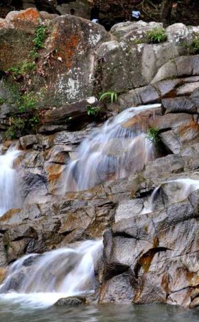
Gunung Telapak Buruk path rises and drops gradually as you pass some small streams. The trail starts downwards about 20 minutes follow by few up and down slopes. Although this is not a famous hiking area but the trail is quite clear with lots of ribbon makers, there are few fallen trees along the way.
What to bring?
What to bring?
We recommend to wear track suit and long sleeve t-shirts as there a lot of plants with thorns along the trail. Also, watch your steps because the track is not as clear as the famous mountains. Always stick with your group or team members. The trail is usually not crowded and you might get lost in the middle of the jungle. And of course, water supply is very important.
Who should I travel with?
Who should I travel with?
Couple , Friends , Group
What to do there?
What to do there?
After an hour of hike, you will reach to an open area, where few pieces of crashed aircraft’s wing on the left-hand side of the open area. The trail on the right will lead you to the main crashed aircraft area. If you continue from the open area, it would leads to Gunung Berembun peak, further down would lead you to Loji Rawatan Air Pantai where you could do a Trans Gunung Berembun. The hike will take you around 1 hour to get to the crashed aircraft area and the same to reach back to the starting point.
What to expect?
What to expect?
Gunung Telapak Buruk is a mountain located near Seremban town, Negeri Sembilan - and stands at a height of 1193 meters, making it one of the tallest mountains in the state. The mountains and adjacent hills form part of the Berembun Forest Reserve, an extensive forest area (around 50,000) in the middle of Negeri Sembilan – that is mainly harvested of timber.
Gunung Telapak Buruk is also getting a bit of press for being the site of World War 2 B-24 Liberator bomber crash, in August 1945. All 8 crew onboard were killed. It is understood that the plane was on a mission to deliver supplies to anti-Japanese guerrillas at that time.
Gunung Telapak Buruk is also getting a bit of press for being the site of World War 2 B-24 Liberator bomber crash, in August 1945. All 8 crew onboard were killed. It is understood that the plane was on a mission to deliver supplies to anti-Japanese guerrillas at that time.
What to see there?
What to see there?
Gunung Telapak Buruk path rises and drops gradually as you pass some small streams. The trail starts downwards about 20 minutes follow by few up and down slopes. Although this is not a famous hiking area but the trail is quite clear with lots of ribbon makers, there are few fallen trees along the way.
What to bring?
What to bring?
We recommend to wear track suit and long sleeve t-shirts as there a lot of plants with thorns along the trail. Also, watch your steps because the track is not as clear as the famous mountains. Always stick with your group or team members. The trail is usually not crowded and you might get lost in the middle of the jungle. And of course, water supply is very important.
Who should I travel with?
Who should I travel with?
Couple , Friends , Group
What to do there?
What to do there?
After an hour of hike, you will reach to an open area, where few pieces of crashed aircraft’s wing on the left-hand side of the open area. The trail on the right will lead you to the main crashed aircraft area. If you continue from the open area, it would leads to Gunung Berembun peak, further down would lead you to Loji Rawatan Air Pantai where you could do a Trans Gunung Berembun. The hike will take you around 1 hour to get to the crashed aircraft area and the same to reach back to the starting point.
